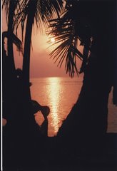
Death Valley National Park is more than just sand. This was the driving force behind my Fall 2011 trip to the Southwest. Of all the National Parks, this one has always held a seductive attraction for me; maybe it was the desolation or the danger, maybe it was the heat or the shear fearsomeness of it I am not sure exactly what it was, but I knew deep down in my bones that this was the year...no, had to be the year, that I go and do...in this land of extremes.
It got off to a bad start right from the beginning. I originally signed up for a Road Scholar program that was to take place in early October and counted the days until I got the OK that the program was a go. It was an ambitious program which was to include a flat water float on the Colorado, tours of Antelope Canyon in Page, Arizona, a pontoon boat ride on Lake Powell, a brief stay in Henderson, Nevada (so I could get my Vegas fix) and then four days in Death Valley, actually staying at the Flint Creek Ranch Inn. It sure was plenty to look forward to! It was cancelled very near to the start date due to lack of interest. What a bummer! So, I had to reshuffle. Check out other programs and make one work for me. I did, I made my own fun for a week getting out to Death Valley and got a full week of hiking in Death Valley while staying in the nearby town of Beatty, Nevada. So I managed to get almost everything in my original program (plus a little more) but under very different circumstances. I went the first week of November, which meant the weather would be very different. In retrospect, that was a good thing, it was brisk at night and delightful during the day, which allowed for pure enjoyment without worry of sunburn, dehydration or a host of other nasties one could encounter closer to summer.
Several years ago a film called "The Bucket List" was popular and I for one really enjoyed it. The story line was a bit far-fetched, but the spirit was solid. Two guys who were both diagnosed with terminal illnesses got together and used the rich guys money to do outlandish things, a pre-composed list of stuff to do before you die. While some of the activities were adventurous and fulfilling in a way, it was the relationship that developed between the two men that seemed to be the most rewarding. It became very popular to say, "well, that's another thing I can scratch off my bucket list." It always struck me as a little cavalier...if I can do everything on my list, then I will have, sort of, cheated death. Presumably, there would be nothing worthwhile left to do, so dying might be the better alternative. So the idea of a bucket list, played in my mind and I fought it. Just the idea of a list, that might have an end and then of course, the end...well it just didn't sit well with me. Nevertheless, I knew, IF I had a bucket list, Death Valley would be on it. Little did I know I may have been flirting with my last hurrah. For two years I have been monitoring what my pulmonologist calls a black fuzzy mass in my chest, it has been dormant...no changes, until this year. Now it is morphing. Taking more drastic steps, I had a bronchoscope (go inside the lung and get biopsies) done hoping to finally determine what it is. But still no answer. At the end of this trip, I am going to have most of my lung removed. My last hurrah indeed.
The first day of hiking was spent at the Mesquite Flat Dunes section of the park. This is what I had envisioned the entire park to be composed of before my arrival; desert as far as the eye could see, dry, desolate and forbidding. Well, yes, there is that but there is a whole lot more than just sand. Having already been to Great Sand Dunes National Park in Colorado, I already knew what it takes to get to the top of a dune and what it looks like from that vantage point. I decided to stay on the lower dunes and get some shots of the weather-beaten sand and the starkness of the landscape.
I was not the only one to opt for the lower, less-traveled road in the group
Another day was spent getting up close and personal with the salt flats, located at Badwater which is 282 feet below sea level, the lowest elevation point in North America. It is actually the remnants of a prehistoric salt lake that has been drying up at a dizzying pace. Here I am holding a chunk of the salt that makes up the flats. It is very hard, sharp and salty!
Another day was spent hiking through and around an area called Artists Pallette, the interplay of the sun on the multicolored surfaces can keep your imagination busy for hours.
Never let it be said that girls don't know how to have fun! The three banditos were getting ready for their next heist while riding in the group van...
We took a walk on the boardwalk leading along Salt Creek Springs, then beyond and into the hills above the meandering salty creek that winds its way through the park. Lots of water, but all salty.
Up in the hills the the Salt Creek seems tiny and the views were pretty remarkable
Another day we spent hiking in Mosaic Canyon, the beauty and awesomeness is really hard to describe.
On one particular hike we had to scale a wall to be able to continue the hike, it was called the Horse because it had foot stirrups and one had to straddle it, like a horse, to get over...
Ok, here I am, Death Valley. It was all I thought it was and more.
Just a little curiosity for me...a fire plug, in the middle of the desert? I just thought it was odd.
Another day was spent hiking Ubehebe Crater, some went down and up and around. I went up and around, that was enough for me.
They don't put up any barriers to prevent you from taking the big dip into the crater, they put warning signs in universal language that even non-English speaking folks can understand!
This is an aerial view of the infamous Scotty's Castle. There are so many stories about this place that it seems to take on a life of its own. It was established during the gold rush and several people were taking advantage of each other during this opportune time. I won't spoil the story but I will tell you, the tour is well worth your time, should you find yourself in Death Valley. Fascinating!
In a ghost town outside of Death Valley, bicycle ghost riders in the sky...
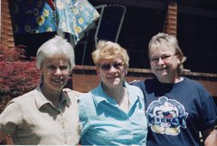
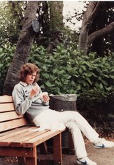
Strolling the grounds of the Furnace Creek Ranch Inn, this is the only lush green you are likely to find in Death Valley. The Inn was established by the old 20Mule Team Borax Company during the turn of the century, here is a delightful woman who also took the program.
Another canyon and another hike...it seems endless here.
Fitting, I think, to end the program with a shot of a beautiful full moon. As the group was disbanding for the last time, several of the program leaders asked if I would like to come back next year and participate as a leader in any of the programs. Would I? You bet! But answer had to be, we will have to wait and see what they find in my chest next week...this may be my last hurrah.